We woke up, started boiling water and packing up the camp.
Perhaps the best thing of the day happened when a young kid, maybe 8 or so, was walking the campground road with his brother. He had seen us pull in originally. In a matter of fact voice he said,
“You guys didn’t look old when you got here.“
We both cracked up! No, we probably didn’t. It’ll happen to you too kid.
In a short while we were on the bikes and heading into the nearby town of Covelo for gas. It was just a few miles down the road.
The night before we looked at maps and made a tentative plan of where we wanted to go. But we also developed a good technique of asking the locals where to go and then adapting the plan.
Our plan was to head north looking for the roads of M1, 336, then 503, 502, 501 to Hwy 36. From 36 we saw a red dotted road we couldn’t identify on the map but it looked interesting and went towards Yreka. That was the plan to start with.

As we pulled into the gas station there was a guy filling up gas cans with his kids. We asked him and while he was a local, he didn’t know much about the roads 100+ miles away. Makes sense, right?
He said to ask the guy in the Napa Auto Parts store next door as he’s been here for 80 years. So Ernie headed into the store to ask. At the same time another truck with locals pulled in for gas and our original guy asked them where we should go. They suggested that we head straight out of town. The street turned into a dirt road and went all the way up to Hwy 36. From there they couldn’t help much.
I went inside Napa and found Ernie looking at maps with someone out back. He was suggesting the same thing. That was all the verification we needed so we were off.
The main street in Covelo is Mina Rd which we were already on. Mina goes all the way up to Hwy 36. It took a little bit but Mina did indeed turn to gravel road. It also got nice and twisty!

Part of Mina Road out of Covelo
Somewhere it turned into Zenia Lake Mountain Rd but kept the 503 designation on the map. There’s no indication except on the map that the name changed. We continued along the ridge tops (great scenery) for miles and miles.

Ernie on Day 2
We came to a spot that had a sign. It was a little shot up but both ways looked like they went to Hwy 36. Most all the signs along the way have been used for target practice once or twice. It was here that we turned to the right on Ruth Zenia Rd. (@40.2007404, -123.4796233). We were now on what looked like 502.
502 turned into Road 511 and the name on the map changed to Van Dozen Rd. Van Dozen led us all the way up to Hwy 36!

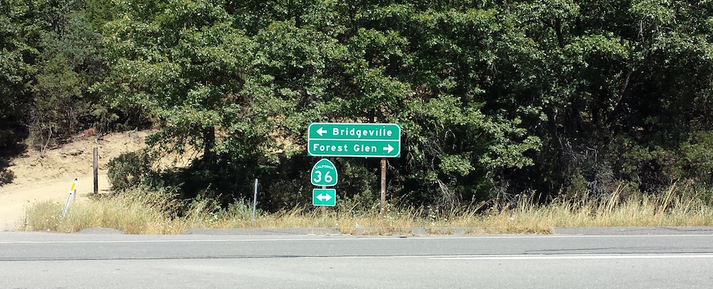
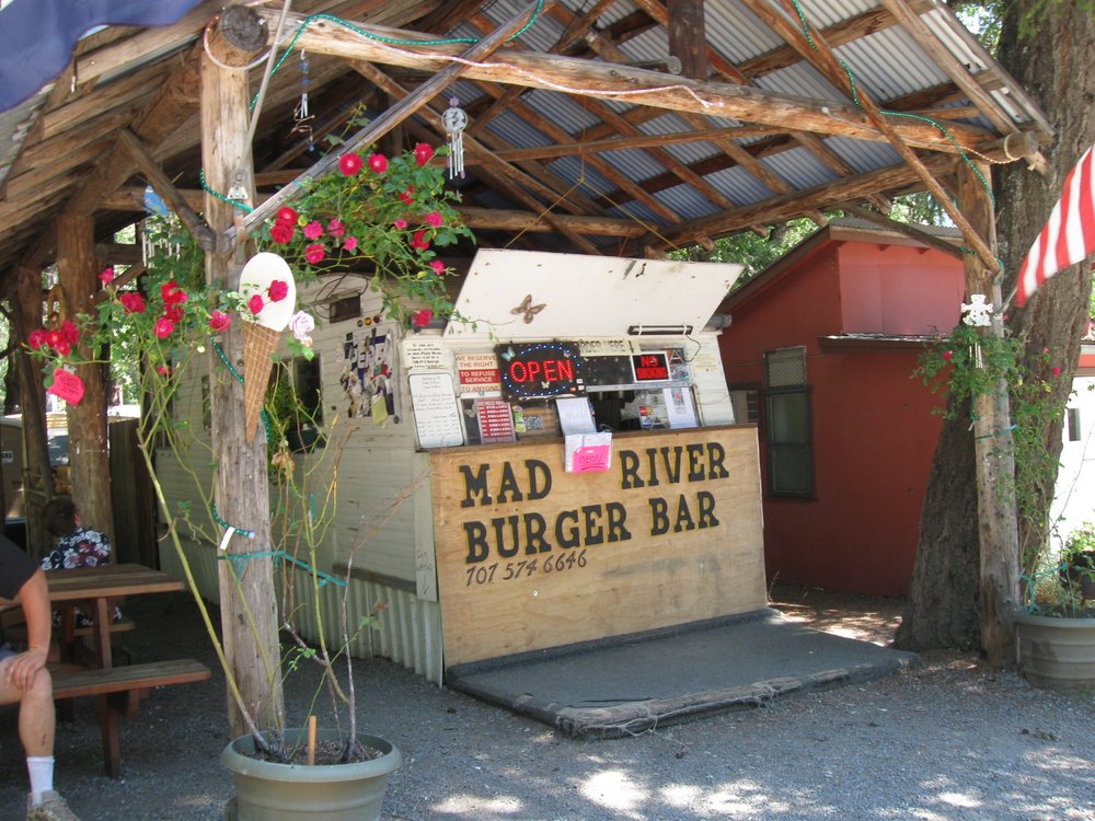
We turned right (east) on Hwy 36 and went down towards the Mad River. Ernie recognized a place on the left and we pulled over to stop. It was the Mad River Burger Bar. He and Tomm had stopped there before. It is literally an old trailer that has been gutted and has just enough room for 3 young girls to work inside. Because of the age I’m guessing at some point that the roof started leaking so they constructed a simple tin roof over the top.

The burgers were good but the best part was the guy in front of us. He was chatting with the girls inside and we heard him jokingly say something like, “Last Halloween I dressed up in my Forest Service outfit, go figure…“. We waited till he was done with his ordering and then Ernie turned to me and said, “Do you know where we are going next?”
I knew exactly what he was doing. I replied that I had maps but wasn’t sure where we were going. The guy turned around on cue and I said, “But I’ll bet you know the area, right?”
And minutes later we were at one of the picnic tables comparing maps and notes with Dan Dill, THE District Ranger for Mad River! What a nice guy!
We explained what we were looking to do (get to Oregon on mostly dirt). He said that it would be tough as there are three National Forests in the way. The Shasta-Trinity, The Six Rivers and the Klamath.
Instead he suggested we head up the road just a 1/4 mile and head north on Forest Hwy 1. It would take us up to Hwy 299 where we could zip into the local town of Willow Creek for gas. From there we could find Hwy 96 and zip up to Happy Camp for the night.
The roads were great! We were riding dual sports and I really put the traction of my knobbies to the test!
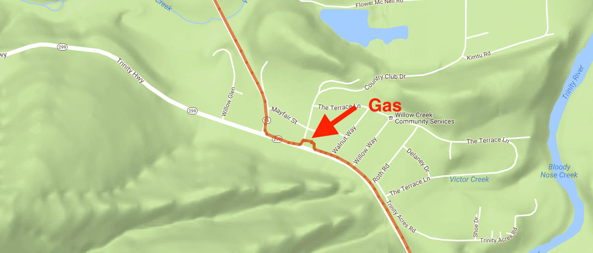
We got to Willow Creek. We filled up with gas and water (our Camelbacks) and were on our way again. A block away from the gas station was the start of Hwy 96. We turned right and headed towards Happy Camp.

Willow Creek Gas Stop
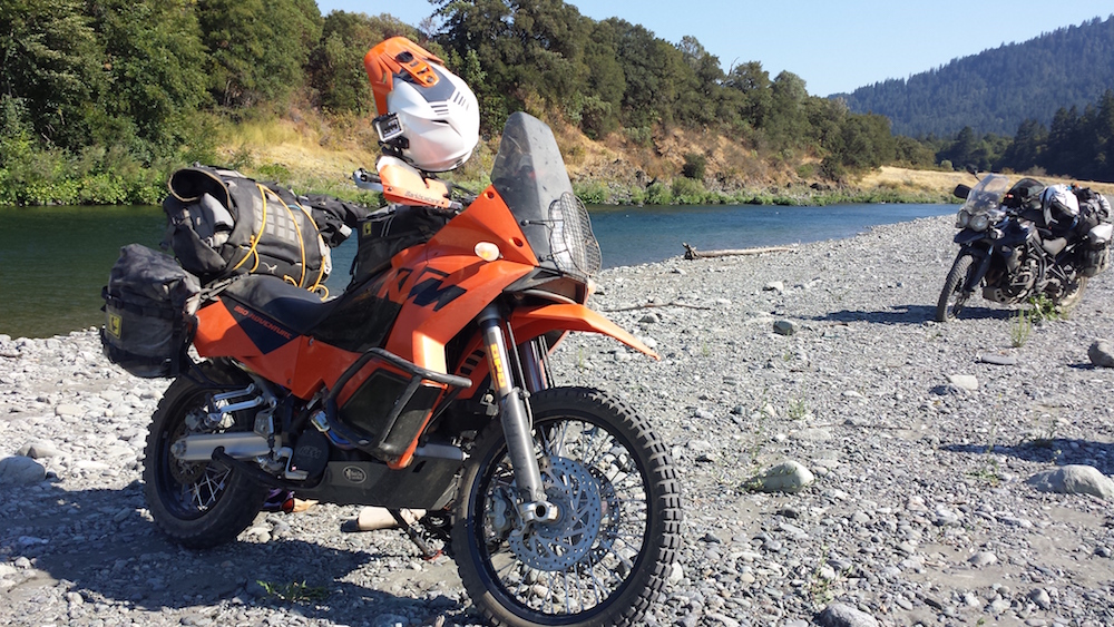
Shortly after we pulled out of Willow Creek we were alongside the Trinity River. It was hot, we were tired and so we pulled off road and on to the rocky shore. I stripped and got wet.
Sorry no pics of my naked ass, but here’s a nice pic of our bikes…

Hwy 96 leads you into the Hoopa Indian Reservation and everything was Hoopa. Hoopa Gas, the Hoopa Casino, the Hoopa Elementary School… I want to learn more about them.
We continued up Hwy 96 to Happy Camp.
Coming into town we saw an RV Campground on the right. Part of what I wanted to do was also stay away from commercial ventures (like this). Seeing nothing else, we headed down the road and guess what we found? A USFS Campground called Curly Jack Campground! Cost for this one was $15 a night.
We were just about alone in this one too. We had good water and were close to the Klamath River. We set up camp and I broke out a bottle of wine. I brought along a nice Mouvedre and hauled it in a spun aluminum bottle. We made freeze dried lasagna for dinner and the two paired perfectly!
After dinner we plotted the next day’s ride. Happy Camp kept us right in between Hwy 10 and Hwy 5 to the east. We found a perfect road that would get us up to Oregon where we could come down 5 for a bit and then hit the Lost Coast. But that’s the tale for another day…
Let’s go read Day 3!
- The Bay Area Adventure Rally - April 16, 2024
- What to Pack on a BDR Trip - March 4, 2024
- I’m selling my 2006 KTM 950 Adventure! - February 16, 2024