Beginning Mileage: 23,079
Officially, this ride was inspired by a post I saw on Facebook from a friend of mine. He and a few of his buddies were embarking on a week+ long trip. Their plan was to avoid pavement as much as possible, ride from Ukiah into Oregon, and rough it all the way. Here’s the image that caught my eye on Facebook.
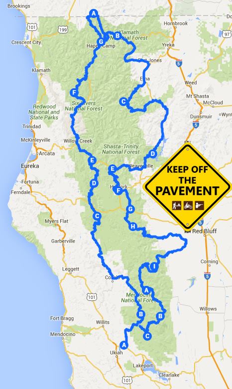
The only problem is that we didn’t have a week. We had 4 days. Could we do their route and if so, how far would we get before having to bee line it back home?
I started looking at Maps trying to best match the trails they had on the image. We adapted a few things. Instead of starting in Ukiah we were starting in Sacramento. We heard of a trail that went from Stonyford to a place above Ukiah (Lake Pillsbury) and so that would be our starting point.
This is Day 1
(read the full ride report here)
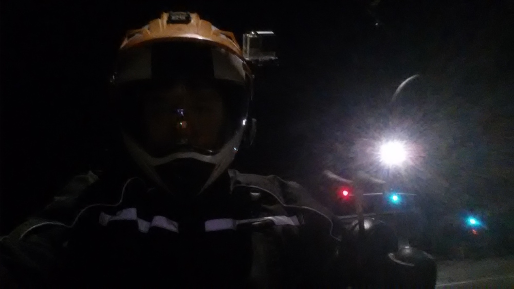
I started at 5 am from my house. The bike was packed and all I had to do was roll it out of the garage and off I went. It’s a little over an hour to Ernie’s in Sacramento.
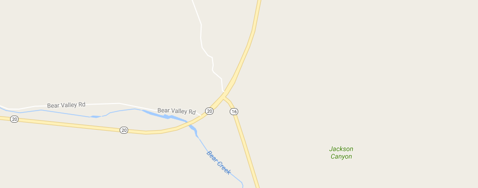
From Ernie’s in Natomas we jumped on Hwy 5 to North on Hwy 16. Our first gas stop was at the Cache creek Casino on Hwy16. You’ll want to stop there and fill up as it’s the last place for miles.
When Hwy 16 hits Hwy 20 you are just about done with pavement for a while. We turned left (W) on Hwy 20 and then immediately turned off on the gravel road (Bear Valley Rd)
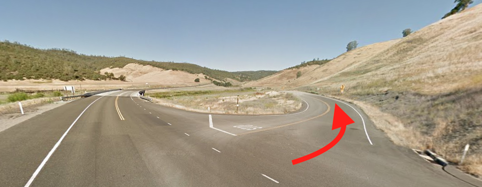
The start of Bear Valley Rd
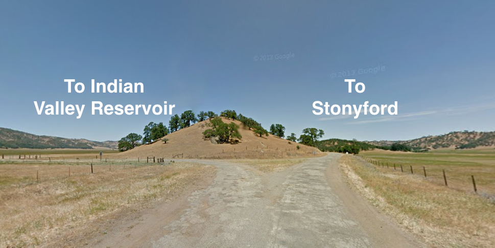
Bear Valley Road will go for a while up and over a ridge. Nothing technical, super easy. As it comes down the ridge it crosses a large valley floor. Just follow the road as it criss crosses the valley floor.
When you get to the end of the valley floor there is a split in the road. Take the right and you’ll end up in Stonyford. That was our original plan. We went left and headed towards Indian Valley Reservoir. It turned out to be the better way to go.
We followed the road up and over to Indian Valley Reservoir. It was labelled as Brim Rd on the map or Route 303 sometimes. In particular we were looking to make our way up above Lake Pillsbury and catch M1 north. We knew we were looking for M12 or M10. We kept seeing signs for both so we knew we were on the right track.
Most of the trail so far was easy. Some of the uphills were a little rougher and you had to pick your lines carefully. There wasn’t much in the way of large rocks so a pinch flat wasn’t likely.
Brim Rd turned into Bartlett Springs rd as it turned north from Indian Valley. A little further on the road turned into Twin Valley Rd. There was a junction of quite a few trails just after a place called “Wild Bill’s Place”. Here’s the route we took.

After Indian Valley Reservoir the climbs were a little bigger and a little more technical.
From there we kept climbing and climbing until we were along the top of the ridge. We travelled along the top of the ridge for a while before dropping down into the town of Upper Lake via Road 301.
We ate lunch at a corner deli on the corner of Hwy 20 and Main St. Gas from across the street and we backtracked back up Road 301 to get back on the path to M1.
Heading North on Road 301 was a little more steep at first. It climbed the ridge and then made it’s way to the west side of Lake Pillsbury. Somewhere along the way we found a sign that said “To M1”.
Road 301 wrapped itself around to the top of the lake where it connected with M1.
M1 climbed up and up and up to the top of Hull Mountain. It got steep in some sections. While it was somewhat technical, all you really had to do was watch your line and keep your momentum up. If you slowed, stopped or spun your back tire you probably were going down.
At the top, we propped the bikes up and took a picture. We didn’t realize it at the time but there was a raging fire going on in Lower Lake (the Clayton Fire). You can barely see the smoke above my mirror.
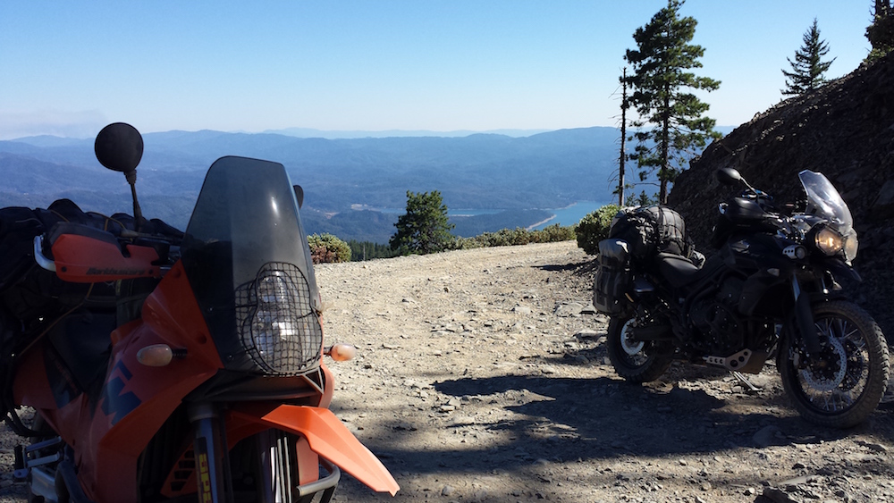
View from the Top of Hull Mountain
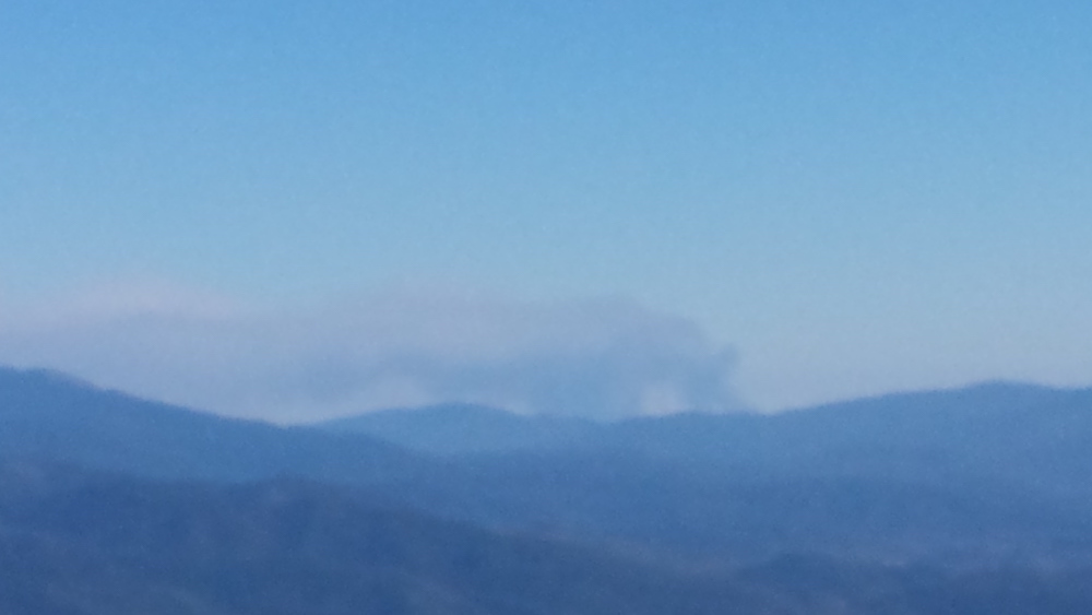
Here’s a zoomed in pic. We were never in danger and were always far from it. It burned over 4,000 acres and over 300 homes were lost!
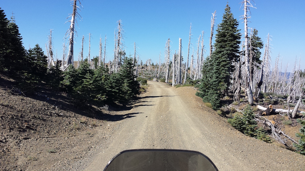
Once we were on M1, you just ride it forever. This section of the route isn’t technical. It will take you along the ridges and you’ll see some excellent scenery. You’ll be riding in more and more forested areas and less traffic to watch out for.
We were always being reminded about the possibility of forrest fires.
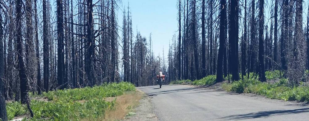
You could say that we had a “Wheelie Good Time”
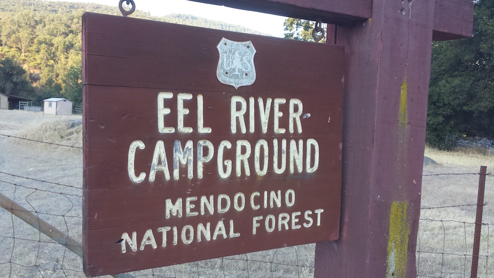
We finally descended off the ridge and down into the valley. The road became less “jeep trail” and more of a groomed gravel road. It dumped us right into the Eel River Campground where we stayed the night.
Cost: $8 – how can you beat that? Plus we were one of the only ones in the campground!
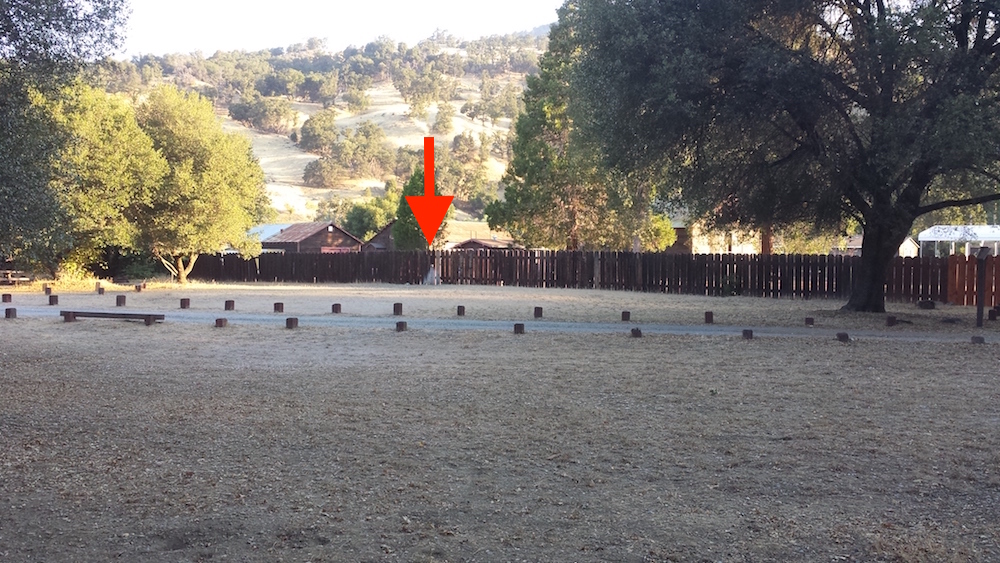
There was one issue with it though. It appeared that there was no water there. We saw a few people drive in and start filling up water bottles at a fence. It’s the only water in the place. It’s not marked and it’s easily missed.
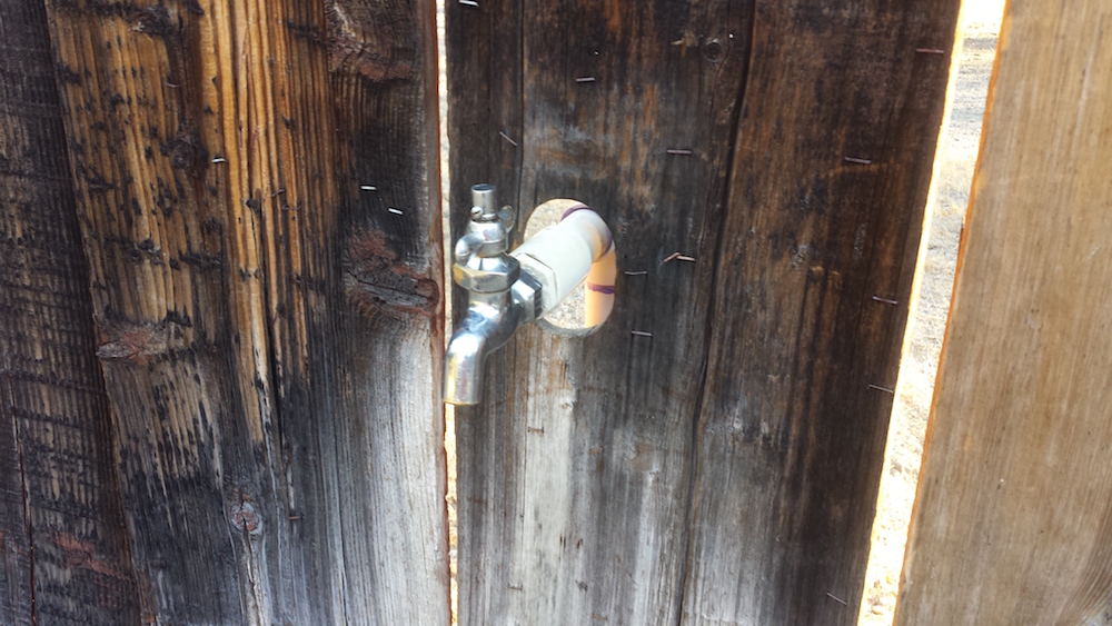
It’s at the fence at the back of the first campsite on the right.
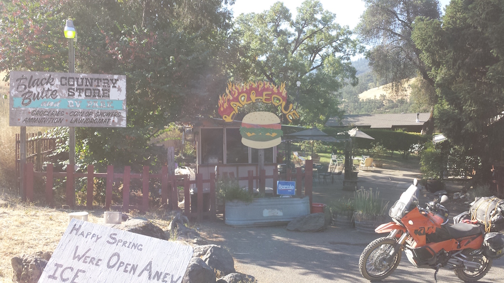
Water is good. Water is essential. But there’s also a cold beer waiting for you just across the street at the Black Butte Country Store. I bought a six pack of a good IPA and we were happy!
Looking back, Day 1 was the most dirt, it was the most challenging with the climb up Hull Mountain. There were plenty of other trails we could have taken. I’d like to go straight up to Stonyford and then catch the M10 westward to Lake Pillsbury next time.
On to Day 2… Eel River to Happy Camp
He's an avid hockey fan, rides a mountain bike, sometimes rides a road bike, has a few motorcycles (he had a really fast one, bought a cool orange one, rode a really slow one, and is currently building a perfect "BDR Weapon"). If that isn't enough, he makes cheese and sourdough bread, loves strong beer and good red wine, and poorly plays the Mandolin.
- The Bay Area Adventure Rally - April 16, 2024
- What to Pack on a BDR Trip - March 4, 2024
- I’m selling my 2006 KTM 950 Adventure! - February 16, 2024